
The Arch, near Aberystwyth
Walks through huge beech trees with views over...
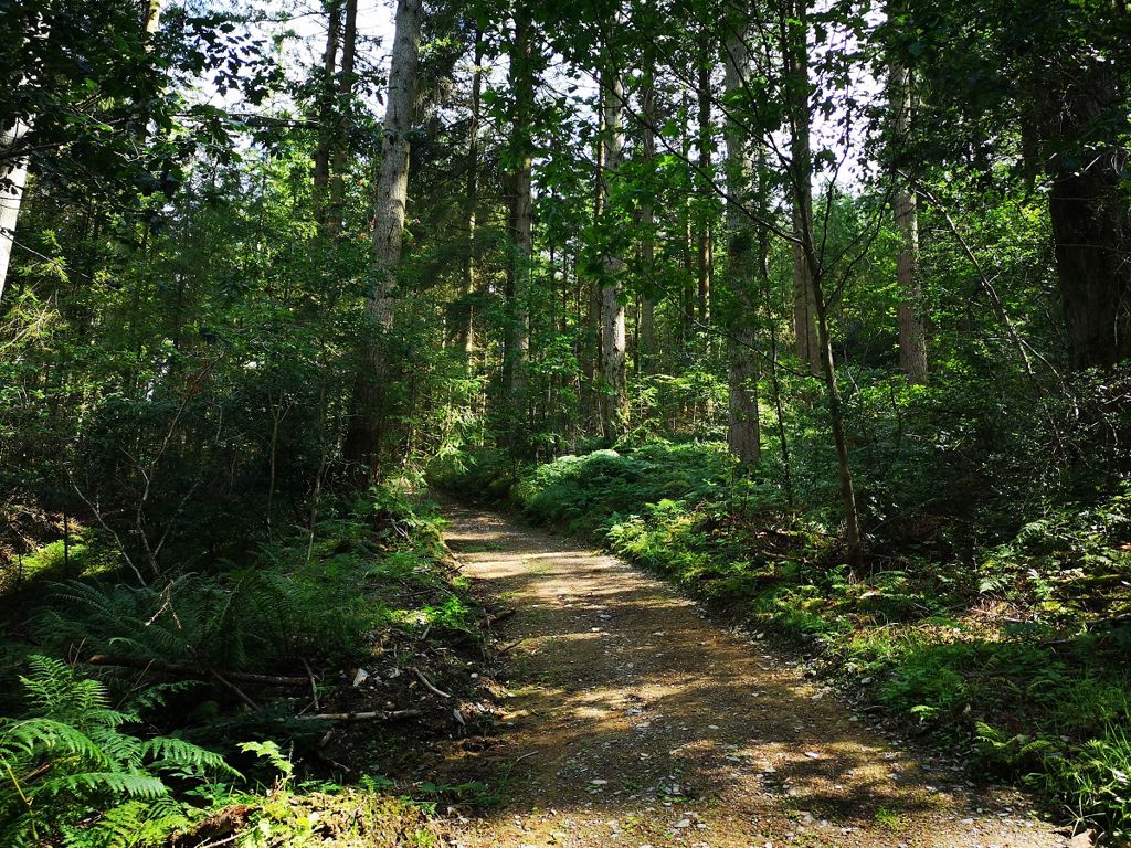
Ty’n y Bedw Wood sits on a steep hillside near the River Ystwyth.
The two walking trails through the woodland start on the other side of the road from the car park - look out for the large wooden signpost.
Grogwynion Nature Reserve is alongside the river and can be accessed from the same car park as the wood.
There is a boardwalk into the reserve and a short path alongside the river.
The small picnic site is down the path from the car park into the nature reserve.
The walking trails are waymarked from start to finish.
Look out for the information panel at the start of the trails.
Find out about walking trail grades.
This short trail has some lovely views across the steep wooded hillsides and a bench about halfway along the route.
This longer trail climbs up through some huge Douglas fir trees.
It then meanders around the hillside on wide forest roads, grassy paths through the woodland and narrow paths alongside a stream.
There are benches along the route to enjoy the views over the Ystwyth valley.

Grogwynion Nature Reserve is alongside the river Ystwyth and can be accessed from the same car park as Coed Ty'n y Bedw.
This section of the river remains one of the wildest in Wales, frequently changing its course after floods.
The reserve is named after a former lead mine and the river gravel is full of heavy metals due to the old lead mines further up the Ystwyth valley. These give rise to an unusual combination of heather, grass and gorse at the river’s edge.
The open views along the floodplain contrast with the steep valley sides which are clothed with trees.
Wildlife at the reserve includes the rare 5-spot ladybird and spiders such as the wolf spider which lives in shingle banks.
We want you to return home safely after your visit here.
You are responsible for your own safety as well as the safety of any children and animals with you during your visit.
For advice and tips to help you plan your visit here go to Visiting our places safely.
See the top of this webpage for details of any planned closures or other changes to visitor facilities here.
For your safety, always follow instructions from staff and signs including those for trail diversions or closures.
We may divert or close trails whilst we undertake maintenance work or other operations and we may need to close other visitor facilities temporarily.
In extreme weather, we may close facilities at short notice due to the risk of injury to visitors and staff.
You may need permission from us to organise an event or to carry out some activities on our land.
Check if you are allowed to use our land.
We recommend you follow these directions or use the Google map below which has a pin on this place’s location.
Ty’n y Bedw Wood is 10 miles south east of Aberystwyth.
Take the B4340 from Aberystwyth to Trawsgoed.
Continue through Trawsgoed and, after 1½ miles, turn left immediately after the bridge.
The car park is after ½ mile on the left.
The Ordnance Survey (OS) grid reference for the car park is SN 694 716 (Explorer Map 213).
The postcode is SY23 4BJ. Please note that this postcode covers a wide area and will not take you directly to the entrance.
Sustrans National Cycle route 82 follows the minor road which goes to the car park. For more information go to the Sustrans website.
View this place on the What3Words website.
The nearest mainline railway station is in Aberystwyth.
For details of public transport go to the Traveline Cymru website.
The car park is signposted as Ty’n y Bedw Woodland and Grogwynion Nature Reserve and you can access both sites from here.
Parking is free of charge.
Overnight parking is not permitted.
There are no staff at this location.
Contact our customer team for general enquiries during office hours, Monday to Friday.


